Here’s what happened.
The Trump administration stood virtually alone at the United Nations after the United States rejected an African-backed resolution calling for changes to the way the world is commonly depicted on maps.
The U.N. General Assembly overwhelmingly approved the “Correct the Map” resolution in a 164-1 vote, with six countries abstaining. The United States cast the only vote against the measure.
The resolution, introduced by Togo on behalf of African nations, encourages governments, schools, international organizations and other institutions to use map projections that more accurately show the relative sizes of continents and countries.
But the Trump administration argued that the United Nations should be spending its time addressing far more pressing international problems.
Trump Administration Rejects UN Map Resolution
Yaryna Ferencevych, deputy U.S. representative to the U.N. Economic and Social Council, delivered a sharp rebuke of the proposal before the vote.
“This resolution mocks the work and purpose of this institution,” Ferencevych said.
The U.S. representative argued that the proposal could not be separated from what Washington considers a broader ideological campaign involving concepts such as reparations and “cognitive justice.”
Instead of debating a map projection developed centuries ago, Ferencevych said the United Nations should concentrate on international peace, economic prosperity and relations between nations.
“Resolutions like this and the ideological agenda they promote, are barnacles on our work here, and the reason this institution is losing its credibility,” she said.
Ferencevych added that initiatives of this kind help explain why, in the administration’s view, the United Nations has struggled with its credibility around the world.
The United States urged other countries to reject the measure. Ultimately, however, Washington was the only nation to vote no.
What Is The “Correct The Map” Resolution?
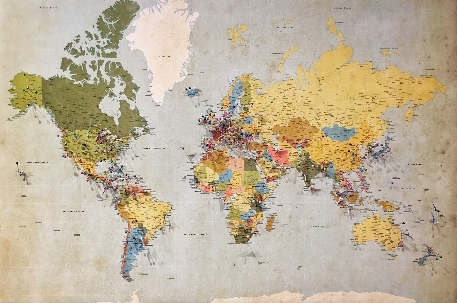
The controversy centers on something millions of Americans have seen since childhood: the traditional world map.
Many commonly recognized world maps use the Mercator projection, which was created by Flemish cartographer Gerardus Mercator in 1569.
The projection proved extremely valuable for navigation because sailors could plot courses using straight lines and maintain constant compass bearings.
But there is a major tradeoff.
Representing a spherical Earth on a flat surface inevitably creates distortions. With the Mercator projection, areas farther from the equator appear increasingly larger than they actually are relative to regions closer to the equator.
That means northern landmasses such as Greenland can appear dramatically larger when compared with Africa than their actual land areas would suggest.
Africa is approximately 14 times larger than Greenland, despite the two appearing much closer in size on some Mercator maps.
Supporters of the U.N. initiative argue that generations of people have therefore developed an inaccurate impression of the true relative size of Africa and other parts of the world.
UN Wants More Accurate World Maps
The resolution encourages greater use of what are known as “equal-area” map projections.
One of the most prominent examples is the Equal Earth projection, developed by cartographers in 2018.
Unlike Mercator, Equal Earth is designed to preserve the relative areas of countries and continents more accurately.
That does not mean Equal Earth is a perfect representation of the planet.
No flat map can perfectly reproduce a spherical Earth. Every projection makes compromises involving characteristics such as shape, area, distance or direction.
The debate is therefore not simply about whether one map is “correct” and another is “wrong.”
Different projections can be useful for different purposes.
UN Resolution Does Not Ban Mercator Maps
One important detail could easily be lost in the political controversy surrounding the vote.
The United Nations resolution does not ban the Mercator projection.
It also does not require the United States or any other country to remove existing maps from schools, government buildings or other institutions.
The resolution is non-binding.
Instead, it encourages governments, schools, international organizations and technology companies to consider equal-area projections when comparing the relative sizes of countries and continents.
It also encourages greater education about the limitations of representing the globe on a flat map.
That distinction is significant because the U.N. vote does not give the international organization authority to dictate which maps Americans must use.
African Union Celebrates UN Vote
The African Union strongly supported the campaign and celebrated the General Assembly’s decision.
African leaders and advocates have argued that the Mercator projection understates the continent’s enormous geographical size and can influence perceptions of Africa’s importance.
Supporters say maps are not merely pieces of geographical information.
They argue that the maps displayed in classrooms, news organizations, government offices and digital platforms can influence how people understand the relative scale and importance of different regions.
The African Union has described the movement toward equal-area projections as an effort to ensure that Africa’s actual geographical scale is accurately represented.
For supporters, Friday’s overwhelming vote represented a major symbolic victory.
Why The United States Voted No
The Trump administration’s objection went beyond the technical question of whether the Mercator projection distorts geographical area.
Washington instead focused heavily on the political arguments surrounding the campaign.
The U.N. resolution discusses the issue in connection with concepts including equitable representation, historical recognition and “cognitive justice.”
Those arguments have transformed what might otherwise appear to be a technical debate among cartographers into a larger political and cultural dispute.
The administration argued that this broader ideological component is precisely why the United States should reject the measure.
Ferencevych said the U.N. should focus on what Washington considers its core responsibilities rather than devoting resources and attention to symbolic initiatives.
Six Countries Abstained
Although the United States was the only country to vote against the resolution, it was not the only nation that declined to support it.
Estonia, Georgia, Lithuania, Moldova, Serbia and Ukraine abstained.
Ukraine raised a separate concern involving how disputed and Russian-occupied Ukrainian territories could appear on maps associated with the Equal Earth projection.
European Union representatives also stressed that implementation of the resolution should not alter internationally recognized borders or imply support for territorial claims.
Those concerns demonstrate another complication surrounding world maps: they do not merely represent geography.
They can also raise sensitive questions involving international borders, disputed territories and sovereignty.
Trump Administration Challenges UN Priorities
The vote comes amid a broader debate over the role and priorities of the United Nations.
The United States has repeatedly argued that international institutions should concentrate on concrete problems involving security, diplomacy and economic stability.
Supporters of the map resolution see the matter differently.
They argue that accurate geographical representation has consequences for education, culture and the way people understand different parts of the world.
That disagreement produced an extraordinary final result.
Of the countries participating in the vote, 164 supported the resolution. Six abstained.
America stood alone in opposition.
What Happens Next?
The vote does not mean traditional world maps will suddenly disappear.
Because the resolution is non-binding, individual governments, schools, publishers, media companies and technology platforms will ultimately make their own decisions about which map projections they use.
The Mercator projection is also unlikely to disappear entirely because it continues to have practical uses, particularly in navigation and certain digital mapping applications.
The larger question is whether Equal Earth and other equal-area projections will become more common in classrooms and general-purpose world maps.
After the overwhelming U.N. vote, supporters of the “Correct the Map” campaign are likely to push institutions around the world to make that change.
The United States, however, has made its position unmistakable.
While supporters say the initiative corrects a centuries-old distortion of Africa’s true geographical size, the Trump administration sees the U.N. campaign as another example of an international institution becoming distracted by ideological debates.
And that disagreement has turned a centuries-old map into the latest international dispute involving Washington and the United Nations.